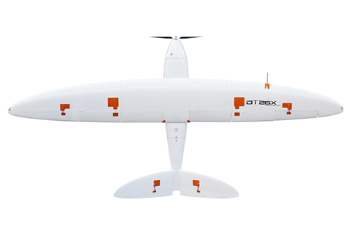
DT26X LiDAR
Accurate and advanced + twice the data in half the time!
The Delair DT26X LiDAR is a unique long range fixed-wing UAV ideal for LiDAR and photogrammetry mapping, survey, monitoring and inspection thanks to its dual sensor payload (1 x Delair RGB camera + 1 x Riegl LiDAR) and Trimble geopositioning module for simultaneous collection of LiDAR and photogrammetry data. This UAV democratises airborne LiDAR by enabling the technology to be used in a much wider range of projects, ideal for a variety of industries including geospatial, power and utilities, mines and quarries, oil and gas, agriculture and forestry, and railways and roads. The solution hugely reduces costs and safety risks, making the DT26X LiDAR a scalable alternative to manned aircraft for corridor and large area mapping.
Key applications include large scale mapping, digital surface and terrain modelling, powerline digitisation and modelling, vegetation classification, and forest inventory.
Key Features:
High quality dual sensor mapping
True point cloud colourisation to simplify the classification process
Safe technology (ready for airworthiness certifications with local CAA)
Enhanced productivity and decreased operational costs
Centimeter-level accuracy
Raw data compatible with all photogrammetry software
Specifications:
Endurance: up to 110 min
Weight: 17 kg
Wingspan/length: 3.3 m/1.6 m
Deployment time: 8 min
Cruise speed: 60 km/h
Take off/landing: catapult/belly (all terrain)
Maximum surface area covered: 9.7 km2 at 120 m
Maximum distance covered: 110 km
Material: composite (fiberglass, carbon, Kevlar), EPP foam
Communication range: up to 30 km (250 m AGL)
LiDAR sensor: RIEGL miniVUX-1DL sensor with a maximum measurement rate of up to 100000 measurements/sec, a maximum range at target reflectivity 60 % of 200 m, a range accuracy of 15 mm, a number of target echoes of 5, a field of view of 46°/102 m at 120 m AGL, and a point density of 35 pts/m2 at 120 m AGL
Industrial-grade RGB camera: Global shutter, distortion free, with a maximum measurement rate of up to 100000 measurements/sec and an image resolution/dynamic range of 21.4 megapixels/70 dB
High precision IMU and L1/L2 GNSS receiver for PPK processing
Operating conditions: 36 km/h wind and moderate rain resistance, -15 to 40 °C temperature range (at sea level), maximum take off and landing altitude/ceiling of 0 to 2000 m ASL/2750 m ASL, and a typical landing accuracy of 15 m x 50 m