UX11
Boost your mapping productivity with a Delair fixed-wing UAV – the smartest mapping drone!
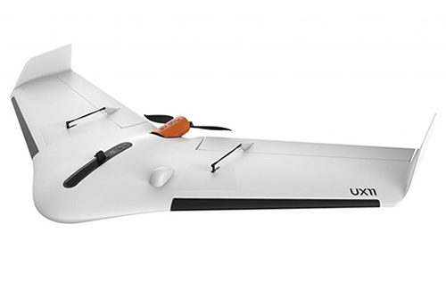
The Delair UX11 is a fixed-wing professional mapping drone offering significant productivity gains, unprecedented ease of use and high quality aerial data acquisition, ideal for work environments ranging from mines, quarries and construction sites to power, utility, oil and gas sites. This UAV leads the way in large area and highly precise mapping, delivering integrated features for before, during and after flight operations, including an embedded global shutter camera, centimeter-level precision dual frequency GNSS sensor (L1, L2), post-processed kinematic (PPK) capabilities for survey grade results (activated flexibly as you go - unlimited or on demand and even retroactively), and both 3G/4G cellular and 2.4 GHz wireless connectivity so you can operate anywhere. The drone’s operational performance is excellent, allowing flights of up to 59 minutes covering over 300 acres at 400 feet whilst getting a 1.7 cm GSD, the UX11 delivers high productivity and high resolution data, ultimately reducing the total cost of ownership compared to other surveying and mapping options.
Delair Flight Deck software allows for intuitive mission planning and monitoring, and with the real-time camera to ground control link, image quality and camera settings can be altered whilst viewing live in-flight photos, allowing you to be confident in your photogrammetry data. The UX11 has bird like take-off and landing, can be hand launched, and will approach for landing at a steeper angle than most fixed-wings and perform a deep stall to land accurately and softly even in confined areas.
After landing, the Delair After Flight software allows you quickly assess your coverage and photo overlap, and helps filter, select and process data including taking care of PPK processing. You can then save readable images (jpg, tiff) in an automatically organised way, ready to be exported to any photogrammetry software including streamlined support for Trimble Business Center where UX11 aerial image data can be processed into powerful deliverables. In addition, you get access to the Delair data-processing cloud-based platform to produce survey grade maps and models, and with an unlimited number of users your drone program can finally be scalable by sharing data and delivering actionable business insights.
Key applications include mapping and GIS, surveying, construction, landfill management, public land management, surface mining, aggregates, and environmental and conservation.
Key Features:
Specifications: